| Podol — Naberezhnoe Shosse |
| 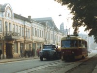 | Since the end of the XIX century, Podol has been
a place of high concentration of trams; no surprise that many pictures thereof
have been take here. This one is on Verhny Val, in the block between
Konstantinovskaya and Zhitny Rynok (market), whose building is visible
behind the pre-revolution two-floor building.
In front of that building are the two vehicles: tram 5766,
which is proceeding along Route 9 towards Krasnaya (Kontraktovaya) Ploschad,
and a ZiL-130 street-washing truck.
[Gordon Stewart, 06.10.1985] |
|
| 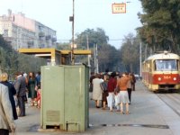 | This and the next picture are taken a little closer to the
Dnieper river, on the boulevard between Verhny and Nizhny Val, in the block
between Konstantinovskaya and Mezhigorskaya.
This short stretch was the only one in Kiev where trams moved on the left side.
Such a pattern came into being after a metro station was opened here, in the late
1970s; the purpose was to have one tram stop serve two lines at the same time.
On the upper right one can see the stop sign for routes 9, 13, 14, attached to
a transverse overhead support wire.
In front of the stop, closer to the photographer, are two seltzer water
vending machines.
[Gordon Stewart, 06.10.1985] |
|
| 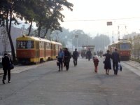 | The same stop on the boulevard, viewed from the opposite direction.
On the left is a train from the Lukyanovka Depot, approaching the stop
and going in the direction of Glubochitsa; on the right,
another train from the Krasin Depot (nowadays Podolskoe), at the stop which
is the terminus of Route 11, going from here to Obolon.
The spot has little changed during the twenty-odd years,
except that the trees have grown some, trams no longer run on the
Route 11 line (since summer 2006), and one can sometimes see more
automobiles in this pedestrian-only space than there are people in this picture.
[Gordon Stewart, 06.10.1985] |
|
| 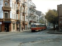 | The intersection of Mezhigorskaya and Yaroslavskaya.
A train from the Krasin depot, lead by 5957, proceeds towards Obolon
on the already-familiar Route 11. A few cars are visible behind.
Almost all the buildings in this picture date back to the pre-revolution era.
[Gordon Stewart, 06.10.1985] |
|
| 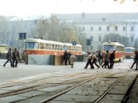 | The northern tram loop at Kontraktovaya Ploschad.
The photographer stands in the emergency stub track;
to the left is the track used by Routes 9 and 13, housing two single cars.
Further left, between two underground passage entrances, is the track of
Routes 12, 14, and 19, with a two-car train headed by 5112.
Nowadays, it is not so spacious here, and the stub track mentioned at the beginning
has been demolished.
[Gordon Stewart, 06.10.1985] |
|
| 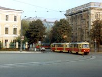 | Leaving Kontraktovaya Ploschad for Ilyinskaya Ulitsa.
A train with 5927 in the head proceeds on Route 31 towards the southern loop.
In the background, a two-door car turns from Ilyinskaya onto Bratskaya, having
just started its run towards Most Patona.
On the left is the three-floor builing of the Kiev Spiritual Academy, dating back
to the XIX century; today, the Kiev-Mogila Academy is there.
The late-Stalinist builing on the right houses the administrative offices
of Kiev's Podolsky District.
[Gordon Stewart, 06.10.1985] |
|
| 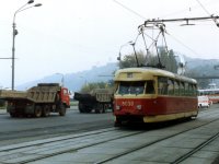 | The stretch of Naberezhno-Kreschatitskaya between
Igorevskaya and Borichev Spusk. Car 5039, one of the last T2s remaining in Kiev
as of that time, is moving towards us, serving Route 32 from DVRZ
to Kontraktovaya Ploschad.
Behind the crossing, one can see the small pedestrian bridge between Rechnoy Vokzal
and the metro station, a part of the Rechnoy Vokzal building itself, and
"the Dnieper's steep heights".
[Gordon Stewart, 06.10.1985] |
|
| 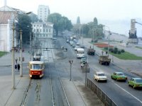 | The same spot viewed from the opposite direction.
One can see Pochtovaya Ploschad, Naberezhno-Kreschatitskaya, and Borichev Spusk.
The shot was taken from the small pedestrian bridge which is visible on
the previous picture.
The two-car train headed by 5225 is crossing Borichev Spusk,
en route to ZZhBK (Route 31).
On the right, against the background of the pedestrian embankment and
the Dnieper's waters, there is the monument to the servicemen of
the Dnieper military flotilla.
[Gordon Stewart, 06.10.1985] |
|
| 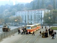 | Another shot from the same bridge over Pochtovaya Ploschad.
The train is bound for Kontraktovaya Ploschad, on Route 21.
Behind the tram is a specimen of industrial architecture of the late XIX century,
the Kiev Tram and Trolleybus Agency building, which used to be the
Aleksandrovsky Tram Depot and later an electric power plant.
Today, the agency is called "Kievpasstrans".
Behind the building, in the middle of the Dnieper slopes, is the
metallic Peoples' Friendship Arch.
[Gordon Stewart, 06.10.1985] |
|
| Kurenevka — Obolon |
| 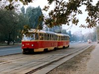 | North of Podol, along Kirillovskaya Ulitsa (nowadays
Ulitsa Frunze), even before the electric tram days there was a horse tram line.
This picture and the next one were taken on that line, which was
electrified in the 1890s.
The place here is next to the sugar plant erected back in the XVIII century
(the stretch between Sakharny Pereulok and Syretskaya Ulitsa).
The train is going towards Podol, serving one of Routes 11, 12, or 19.
Another train is visible in the background.
[Gordon Stewart, 07.10.1985] |
|
| 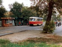 | The tram stop near Kurenevsky Rynok (aka Ptichy Rynok, or Bird Market).
Tram tracks run away from us towards Ulitsa Semena Sklyarenko;
car 5294 is moving in the opposite direction, on Route 12 from Puscha-Voditsa towards Podol.
A kiosk of Soyuzpechat (the press distribution agency in the USSR)
stands next to the tram stop.
Nowadays, only that stop is still there, whereas the one in the opposite direction
has been removed, because the next one, Ulitsa Sklyarenko, is quite close by.
[Gordon Stewart, 07.10.1985] |
|
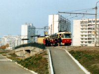
| 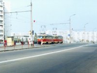 | This and all the following pictures have been taken in
the neighborhood of Obolon.
Ulitsa Zoi Gayday has lent its name to the tram stop.
The train headed by 5227 is going, most probably, towards Kurenevsky Rynok on Route 16.
Cars are only visible near the horizon...
[Gordon Stewart, 06.10.1985] |
|
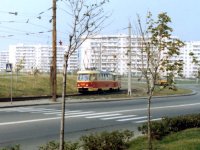
|  | The same Ulitsa Zoi Gayday, viewed from the sidewalk,
towards the tram stop by the same name.
The two-car train is probably going to Kurenevka on Route 16.
Behind the embankment carrying the roadway and the tram tracks, one can see
a food store sign.
[Gordon Stewart, 07.10.1985] |
|
|  | The tram line turns from Ulitsa Timoshenko onto Zoi Gayday;
the two-car train headed by 5203 must be on Route 16 again.
An Ikarus 280, most probably from Route 99, is entering the intersection, too.
The rear of a Volga GAZ-24 is visible on the right.
The apartment blocks in the background look brand new —
they are not old as yet, indeed.
[Gordon Stewart, 06.10.1985] |
|
| 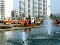 | Ploschad Druzhby Narodov. In the foreground one can see
a cooling fountain. Behind it, a single car 5944 is proceeding along Route 4
or 11 towards Ulitsa Lajosa Gavro, a common terminus of those two routes.
[Gordon Stewart, 06.10.1985] |
|
| 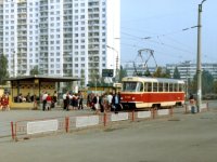 | The same spot. This car is going on Route 4
towards Metro Geroev Dnepra. Route 4 ran entirely within the neighborhood
of Obolon, connecting its different parts. Beginning in 1982,
it was passing by two metro stations: Prospekt Korneychuka (nowadays Obolon) and Geroev Dnepra.
On the left, behind the tram shelter, there is an Ikarus 280, most probably from
Route 100 or 102.
[Gordon Stewart, 06.10.1985] |
|
| 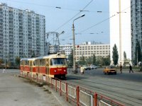 | Turning from Ulitsa Malinovskogo onto Lajosa Gavro.
The train of two three-door cars is bound for the Lajosa Gavro terminus.
Partially visible on the right is the intersection of the two streets
with a roundabout and a flower bed in the center.
[Gordon Stewart, 06.10.1985] |
|